The Geoinformatics Center of the Asian Institute of Technology (AIT) has prepared change detection maps to help disaster rescue and relief operations following the Lombok earthquake in Indonesia. A Disaster Charter was activated on 6 August 2018 after the second earthquake of 6.9 earthquake struck the Indonesian island of Lombok.
The Disaster Charter is a worldwide collaboration wherein satellite data is collected and provided for disaster management. Earth observation images and data from different space agencies is collected and collated, which is then made available for rapid response to help civil protection authorities and the international humanitarian community.
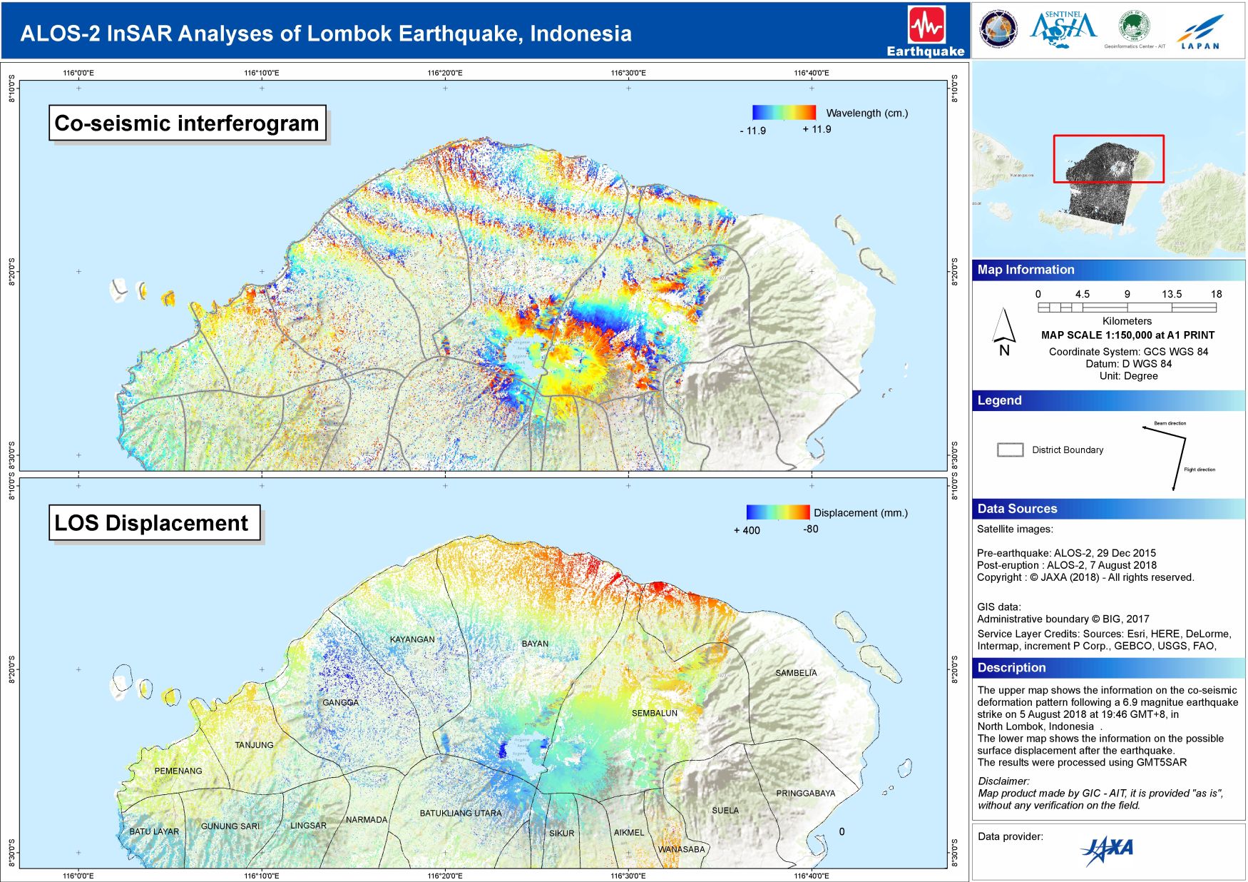
AIT is the project manager for the Disaster Charter for Lombok, and this charter was activated after receiving a request from the Asian Disaster Reduction Center (ADRC) on behalf of the National Institute of Aeronautics and Space (LAPAN), Indonesia. GIC has produced a map which depicts the co-seismic deformation pattern after the earthquake.Another map shows the possible surface displacement.
Organizations that are contributing towards producing spatial products in response to the Lombok earthquake include Gadjah Mada University, United Nations Institute for Training and Research (UNITAR//UNOSAT), Copernicus Emergency Management Service (EMS), LAPAN, Service Régional de Traitement d'Image et de Télédétection (SERTIT, France), and Geofinformatics Center (GIC, AIT).
More details are available at this link https://disasterscharter.org/web/guest/activations/-/article/earthquake-in-indonesia-activation-580-
